The road of the Cannons
An ambitious project brings together ten municipalities and two valleys in a joint initiative to revitalise and enhance the mountain environment, designed to promote and develop a new way of experiencing the outdoors, combining nature, culture and sustainable tourism.
To the rythm of the cannons
The Road of the Cannons is an ancient military route built in the 18th century at the behest of Charles Emmanuel III of Savoy.
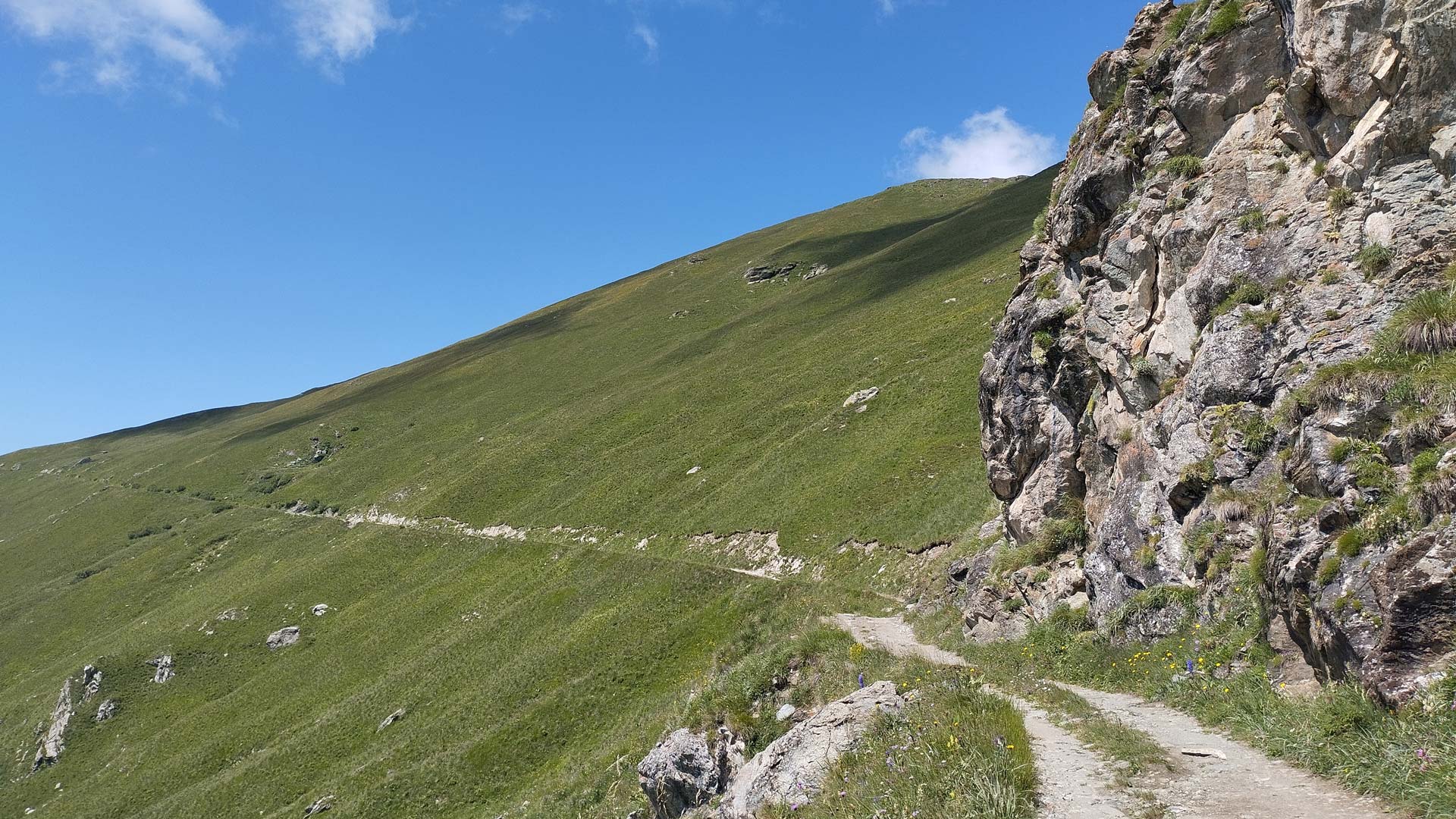
Its original purpose was to link the valleys and facilitate the transport of artillery and supplies between the Alpine fortifications. The route, largely unpaved with some initial tarmac sections, offers breathtaking views of the Maritime and Cottian Alps. Suitable for experienced hikers and mountain bikers, it combines nature, history and Alpine culture.
A journey through history and nature, with a view of the Alps
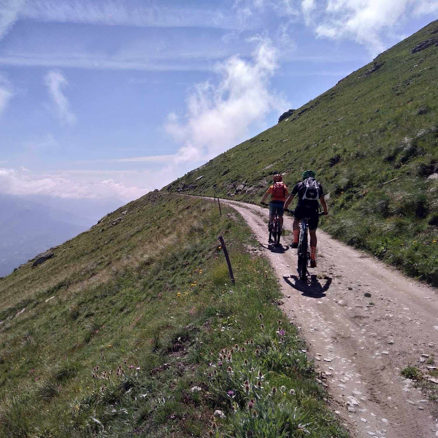
Today, the Road of the Cannons is a path to freedom: 40 kilometres suspended between sky and mountains, where every step offers views and a tranquillity that remain etched in the heart. A route linking the Maira Valley and the Varaita Valley, taking in ancient mule tracks, spectacular ridges and historical landmarks. An invitation to slow down, listen to nature and rediscover the deep bond between man and the mountains.
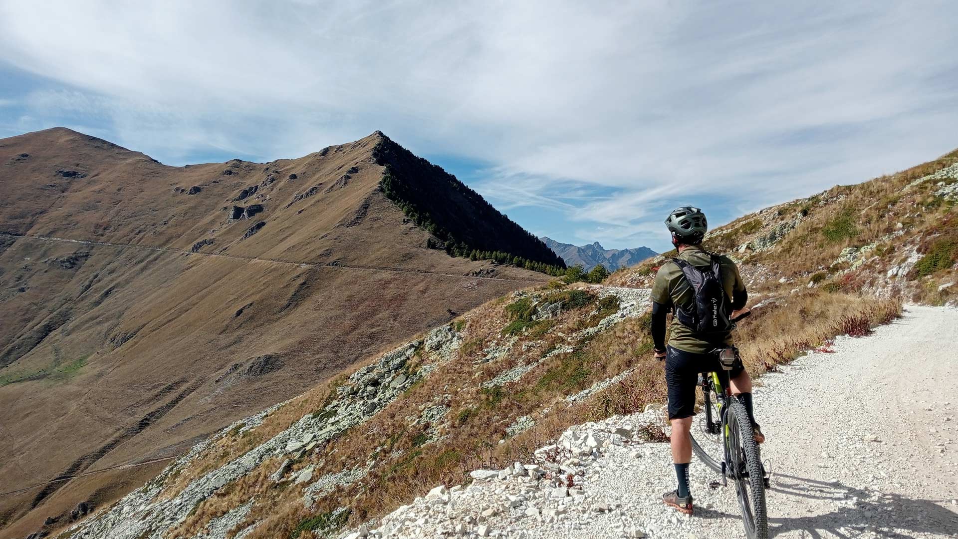
Above 1,500 metres, the vegetation becomes sparser. The northern slopes, between Colle di Valmala and Colle del Birrone, are tinged with the pink of rhododendrons in June and the orange of rowan berries in August; the southern slope, on the other hand, offers an endless succession of pastures that shift from the bright green of spring to the brown hues of autumn.
On clear days, the view stretches across the entire south-western Alpine arc: to the far east, the Ligurian and Maritime Alps, with the peaks of the Argentera massif dominating the scene; to the west, the Cottian Alps offer a breathtaking finale: the trio of three 3,000-metre peaks, Chersogno (3,024 m a.s.l.), Pelvo (3,061 m a.s.l.) and Marchisa (3,072 m a.s.l.) framing the pleasant Elva valley. Motionless and statuesque, Monviso, at 3,841 m a.s.l., welcomes those arriving at the Sampeyre pass, as if it were a motionless and silent guardian. The view stretches far to the north, where the valleys of the Turin area are easily visible, all the way to the iconic pyramid of the Matterhorn and the Monterosa massif.
Technical information
- Distance: 43.10 km
- Starting altitude: 609 m
- Finishing altitude: 2,286 m
- Elevation gain: +1,875 m / -200 m
- Recommended period: June to September
- Highest point: Colle della Bicocca (2,287 m)
- Starting point: Colletta di Rossana (560 m)
The "Road of the Cannons" starts at Colletta di Rossana and stretches for around 40 kilometres between the Maira Valley and the Varaita Valley, ending at Colle della Bicocca. It consists of a dirt track, with tarmac only on a few sections at the start.
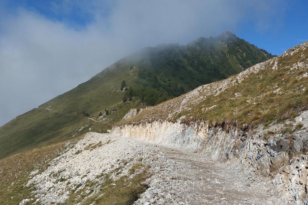
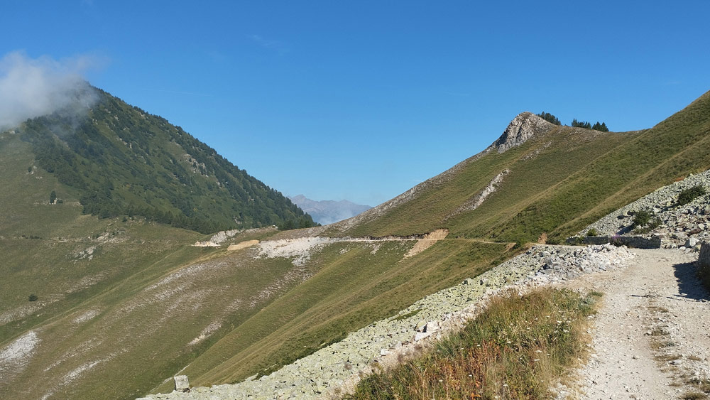
From Colle della Ciabra to Colle del Birrone (alt. 1,700 m), the road continues for about 8 km along a dirt track in reasonably good condition. Thereafter, up to Colle di Sampeyre (alt. 2,284 m), the route is in poor condition, particularly on the section running along the slope facing the Varaita Valley up to Colle del Rastcias (alt. 2,176 m).
Afterwards, the high-altitude road returns to being in fairly good condition, although it is very narrow and exposed.
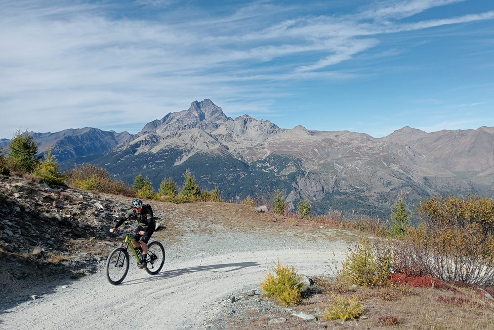
The final 7 km separating Colle di Sampeyre from Colle della Bicocca (alt. 2,285 m) are also in fairly good condition.
A destination for cycling and hiking
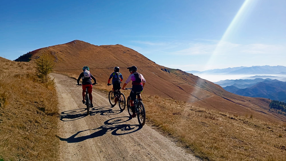
The ideal destination for cyclists
The Road of the Cannons is primarily designed as a high-altitude cycle route. Stretching 43 km with an elevation gain of 1,875 metres, it is not a route suitable for everyone, but it offers some spectacular sections.
For those looking for something more accessible, the link between Colle della Ciabra (1,712 metres above sea level) and Colle del Birrone (1,698 metres above sea level) is flat, free of technical difficulties, particularly smooth and well worth the effort in terms of scenery.
To the keen eye of the cyclist arriving from the Cuneo plain, the thin line cutting diagonally across the steep slopes of Mounts Birrone, Rastciàs, Lubin, Cugulet, Nebin and Morfreid, coming to a halt at the foot of Mount Pelvo d’Elva (3,064 m a.s.l.), and the mind drifts to legendary climbs and hours spent in the saddle.
The journey begins at an altitude of 560 metres above sea level at Colletta di Rossana, in the municipality of Busca, where the mild climate of the plain gradually gives way to the crisp mountain air. The “Cima Coppi” of the route is the Colle della Bicocca, at 2,287 metres above sea level, situated 3 km north-west of the more famous Colle di Sampeyre (2,283 metres above sea level).
The first part of the route alternates between two sections on tarmac: the first 3.7 km, from Colletta di Rossana (609 metres above sea level) towards Colle della Liretta, and from the junction leading to the hamlet of Lemma to Colle della Ciabra (1,712 metres above sea level) – 6.4 km.
Suggestions for hiking
For hiking enthusiasts, the Road of the Cannons is the hub of numerous circular routes that offer unforgettable experiences all year round.
- The slopes of Mount San Bernardo, wooded on the northern side and rocky and grassy on the opposite side, are ideal for those wishing to tackle circular walks whilst enjoying the panorama that opens up along the mountain ridge, with views stretching across the Cuneo and Turin plains and over the Piedmontese and Valle d’Aosta sections of the Alps.
- Mount Roccerè, a site of extraordinary archaeological value, where one can observe the mysterious cup marks carved into the gneiss, dating back to the Bronze Age.
- The panoramic ‘skyline’ trail that leads from the Ciabra Pass to the summit of Mount Birrone, winding through monoliths with the constant presence of Mount Monviso to the north.
The Road of the Cannons is, in every sense, an extraordinary destination for all outdoor enthusiasts, but it requires skill, preparation and the right equipment to tackle. Only by following the rules of the mountains can you ensure a truly unique experience!
Rules and opening times
OPENING PROCEDURES
- Access restricted to pedestrians and cyclists only: Five days a week (Monday, Wednesday, Friday, Saturday and Sunday)
- Open to motor vehicles (cars, motorbikes and quads): Tuesdays and Thursdays
The municipal traffic regulation by-law has been in force since 14 July 2025, with no controlled access points installed and no entry permits required for vehicles.
The regulations governing access to and transit along the former Military Road are available for consultation on the municipality’s official website.